The Santa Clara City Council has approved new requirements for development along El Camino Real — with a few changes.
At a special meeting Tuesday night, the Council adopted the El Camino Real Specific Plan, but directed City employees to return with some amendments. The plan establishes, among other things, objective design standards, new affordable housing requirements and re-establishes density thresholds for development along the City’s main corridor.
Andrew Crabtree, Director of Community Development, said the City conducted exhaustive community outreach, including workshops, popups at public events such as the art and wine festival and farmers market, online surveys and a virtual open house to establish the guidelines in the plan.
With adoption of the plan, El Camino will now have three density designations instead of two. Those density thresholds originally ranged from 16 to 45 units per acre to 55 to 100 units per acre with heights ranging between three and six stories. However, a change to the recommendation required City employees to return to the Council with a narrower range for the density and a lower cap on building height.
Although Vice Mayor Raj Chahal did not quantify “lower the density” and range of density in his motion to give City employees direction, he did enumerate the cap on building height, specifying that the plan cap residential buildings at two stories, mixed use buildings at three stories and commercial buildings at four stories.
Crabtree said the new designations aim to make the 3.2-mile corridor more “walkable.” Objective design standards — such as a setback requirement that mandates one foot of setback for every foot of building height — aim to codify what the City wants to see along the thoroughfare.
“Including policies to address the interface between new development and existing was a key focus of the specific plan effort,” he said.
Improving bike lanes was also a priority, Crabtree said. As a result, eliminating a significant portion of street parking was necessary. Public comments swelled with opinions about parking, both supporting and opposing its removal.
A new affordable housing requirement was also on the table. A mandatory 15% affordable housing — designated at 80% area median income — was also proposed as part of the specific plan.
2020 Census District Lines Forthcoming
Also on the docket was redistricting for the 2020 census. The Council opted to aim for a seven member committee to establish the districts: one member from each district and one at-large. Should that not be viable — considering City Attorney Brian Doyle’s comment that the City had trouble securing three people for a similar committee — a five or three member committee was allowed as a contingency.
Further, the Council decided to allow an independent committee to draw the lines for the six districts. That decision was uncontroversial. However, the Council’s decision to have random applicants sit on the committee that determines how the districts are redrawn did not go over well with Mayor Lisa Gillmor.
“Throw them in a hat. That is what this Council wants,” she said. “I don’t think that should be anything to be proud of.”
Council Member Kathy Watanabe’s motion to allow the diversity task force to make the decision failed in a 5-2 vote, with only her and Gillmor voting “yes.” The choice to have the lot be random passed 4-3, with Watanabe, Gillmor and Council Member Kevin Park voting against it.
In a further complication, Park took issue with the hiring of consulting firm Lapkoff & Gobalet, who drew lines for the court-order six-district map as well as the City’s census maps for the past three censuses.
Park said the demographer made mistakes in drawing district lines along major thoroughfares, and he would like the Council to consider a change. But City Manager Deanna Santana said there simply is not enough time to hire another consultant.
City Clerk Hosam Haggag said the City expects to receive census data no earlier than September and must have the new districts drawn by April next year. He said he expects no major changes to the map given that the City underwent districting in response to the California Voting Rights Act lawsuit the city lost.
Gillmor had problems with Park’s raising of the issue.
“This is why we cannot get through Council meetings. We bring up things that are not on the agenda. We go into different areas. We start micro-managing. We say we want a hands-off, but we want hands-on,” she said. “We had four items on this agenda, and we can’t even get through them. We have a problem here, Council. A big problem.”
Data Center, IT Contract Get Thumbs Up
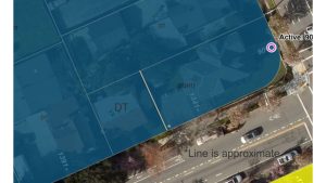
The Council also unanimously approved a rezoning for a data center. A 250,000 square foot, four-story data center located at 2905 Stender Way was rezoned to planned development to narrow its parking requirement.
The 3.9-acre data center comes with the addition of a 48 megawatt substation that will add nearly $2.5 million to the City’s general fund, which saw $22.7 million funnel into it from data centers in 2020.
As part of the adoption, the Council also required the center to switch to recycled water and install noise monitoring equipment onsite.
The Council also approved four one-year options with Unisys Corporation for information technology services. The value on the initial term through the end of June 2022 is $8.35 million.
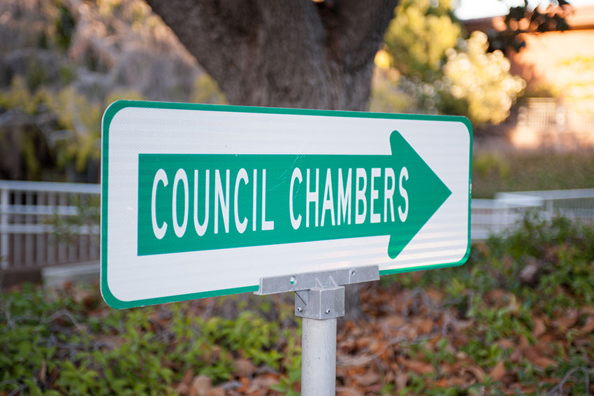
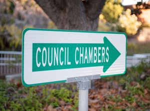
The next regularly scheduled meeting is Tuesday, June 22 in the Council Chambers at City Hall, 1500 Warburton Ave. in Santa Clara.
Members of the public can participate in the City Council meetings on Zoom at https://santaclaraca.zoom.us/j/99706759306; Meeting ID: 997-0675-9306 or call 1(669) 900-6833, via the City’s eComment (available during the meeting) or by email to PublicComment@santaclaraca.gov


0 comments